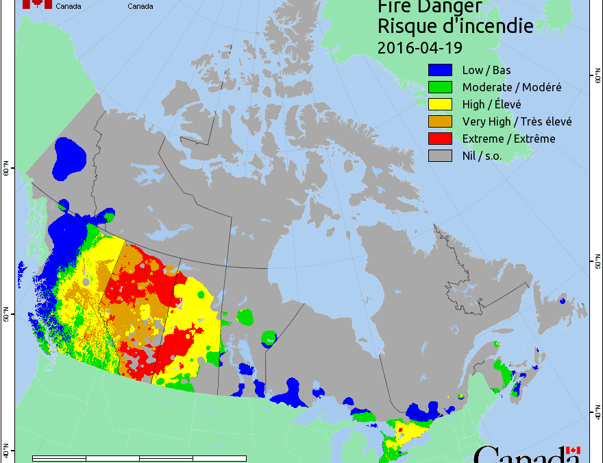
REGINA – Large swaths of red, meaning extreme risk, cover Alberta and Saskatchewan on the latest fire danger map from Natural Resources Canada.
Many other areas are considered high or very high risk in the two Prairie provinces, where there’s been below average snowfall and above normal temperatures.
Terry Anderson, a fire research officer with Natural Resources Canada, says that warm weather melted snow faster than usual and left the ground tinder dry.
Anderson says it’s unusual to see the fire danger risk this high, this early.
He says it’s a dangerous condition for grass fires, which can spark easily and move very quickly.
However, Anderson says that doesn’t mean there will be more forest fires later this summer, because cooler, moister air expected in June or July could reduce the risk.
(The Canadian Press)
